What Does ‘Scattered’ Mean in Aviation Terms?
In aviation meteorology, ‘scattered’ represents a precise technical designation for cloud coverage spanning 3/8 to 4/8 (37.5% to 50%) of the sky. Weather forecasters typically translate this condition into more familiar terms like ‘partly cloudy’ or ‘partly sunny’ for general audiences.
Here’s the crucial distinction: scattered clouds never constitute an aviation ceiling. A ceiling forms only when the lowest cloud layer blankets more than half the sky—requiring either ‘broken’ coverage (5/8 to 7/8) or complete ‘overcast’ conditions (8/8).
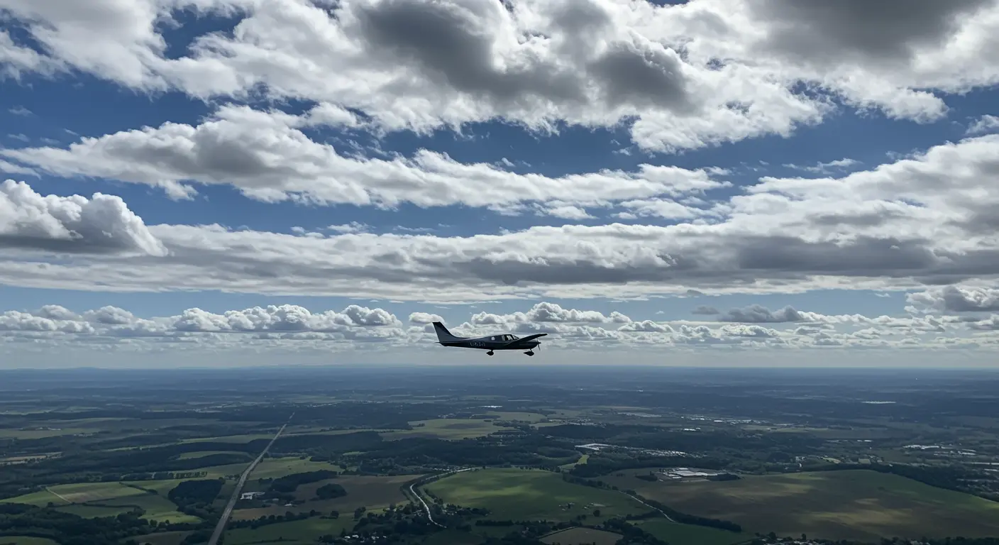
Pilots can typically weave around scattered clouds while maintaining visual flight rules (VFR), thanks to ample clear space between formations. However, these clouds require careful consideration in flight planning—they can compromise visibility and often herald shifting weather patterns.
Understanding Cloud Ceilings and Their Importance
Cloud ceilings hold particular significance for pilots operating under Visual Flight Rules (VFR). When ceilings drop too low, they can ground takeoffs and landings or force pilots to switch to Instrument Flight Rules (IFR). VFR operations typically demand minimum ceilings of 1,000 feet in controlled airspace and 500 feet in uncontrolled zones, though specific requirements fluctuate by location.
Why do ceiling heights matter so much? They serve as a safety buffer, allowing VFR pilots to steer clear of Instrument Meteorological Conditions (IMC) while helping IFR pilots strategize their approaches and departures. Meteorologists also leverage this data to anticipate weather shifts that could disrupt flight operations.
Cloud Coverage Types: From Clear to Overcast
Aviation meteorology employs a systematic approach to categorize cloud coverage, measuring the fraction of sky obscured in octal (eighths). This standardized framework ensures clear communication in weather reports and encompasses several distinct classifications:
| Term (Abbreviation) | Sky Coverage (Octal) | Description |
|—|—|—|
| Clear (SKC/CLR) | 0/8 | No clouds detected. |
| Few (FEW) | 1/8 to 2/8 | Sparse clouds; does not constitute a ceiling. |
| Scattered (SCT) | 3/8 to 4/8 | ‘Partly cloudy’; does not constitute a ceiling. |
| Broken (BKN) | 5/8 to 7/8 | The first layer that constitutes a ceiling. |
| Overcast (PVC) | 8/8 | Complete cloud cover; constitutes a ceiling. |
| Sky Obscured (VS) | N/A | Sky is hidden by phenomena like fog or smoke. |
This USA-based measurement system provides the foundation for ceiling determination and is essential for accurate weather reporting in aviation. It underpins the METAR and TAF reports that pilots depend on for comprehensive flight planning.
How Scattered Clouds Impact Flight Planning
While scattered clouds may not create a ceiling, they significantly affect flight planning and operations. Pilots must weigh multiple factors when these formations dot the sky.
Scattered clouds offer VFR pilots the flexibility to maintain visual flight by threading between formations. However, strict cloud clearance minimums still apply—typically 500 feet below, 1,000 feet above, and 2,000 feet horizontally from any cloud.
These formations can also diminish visibility through shadow play, complicating landmark identification and aircraft spotting—particularly during the golden hours of dawn and dusk. Additionally, turbulence, up drafts, or downdrafts may lurk nearby, especially around towering cumulus clouds.
Smart pilots anticipate that scattered clouds might evolve into broken or overcast conditions, necessitating backup routes or alternate airports. Such dynamic conditions pose particular challenges for student pilots or those with limited experience.
Specialized operations face unique hurdles. Aerial photography and surveying missions can suffer from shadow interference, potentially forcing costly rescheduling or route modifications.
Methods for Measuring Cloud Height and Ceilings
Precise measurement of cloud height and ceilings stands as a cornerstone of aviation safety and weather forecasting. Multiple techniques serve this critical function, each offering unique strengths.
-
Laser Ceilometers: These automated systems use vertical laser pulses to measure cloud bases up to 25,000 feet. They are the primary tool at most major airports due to their reliability.
-
Ceiling Balloons: A balloon with a known ascent rate is released, and the time it takes to enter the cloud base is used to calculate height. This method is useful where electronic equipment is unavailable.
-
Optical Drum Ceilometers: Largely replaced by laser technology, these systems project a light beam to triangulate cloud height and may still be used as backups or at smaller airports.
-
Pilot Reports (Preps): Pilots provide real-time, in-flight observations of cloud conditions, which are crucial for supplementing ground-based data, especially in remote areas.
-
Weather Observer Estimates: Trained personnel estimate cloud heights by referencing known landmarks like towers or terrain. Despite being subjective, these estimates can be highly accurate for lower cloud layers.
Contemporary weather services combine data from these diverse methods, creating a comprehensive picture of ceiling conditions. This multi-source approach compensates for individual technique limitations while ensuring pilots receive the most reliable information possible.
Understanding METAR Reports for Cloud Ceilings
METAR (Meteorological Aerodrome Report) serves as aviation’s universal language for weather communication, delivering critical cloud coverage and ceiling intelligence. Mastering the interpretation of cloud data within these reports is essential for pilots and aviation professionals alike.
METAR cloud information follows a precise structure: coverage abbreviation paired with height expressed in hundreds of feet above aerodrome elevation. Scattered clouds appear as “SCT”—so “SCT030” translates to scattered clouds with bases at 3,000 feet above airport level.
Complex METAR reports often feature multiple cloud layers, arranged in ascending altitude order. Consider “SCT025 BKN040 OVC080″—this reveals scattered clouds at 2,500 feet, broken coverage at 4,000 feet, and overcast conditions at 8,000 feet. The ceiling sits at 4,000 feet since the broken layer represents the lowest formation covering more than half the sky.
Special cloud notations add crucial safety intelligence to Meters. “CB” flags cumulonimbus clouds (thunderstorms), while “TCU” identifies towering cumulus—both signaling potentially dangerous conditions. When obscuring phenomena block cloud observation, “VS///” (vertical visibility indefinite) indicates a ceiling exists but remains unmeasurable.
Automated METAR stations (designated “AUTO”) rely on ceilometers but face inherent constraints—they cannot distinguish cloud types or detect formations above 12,000 feet. This is why human-augmented observations remain invaluable for comprehensive weather reporting.
Conclusion: The Role of Scattered Clouds in Aviation
Understanding the nature and implications of scattered clouds is fundamental to safe, efficient aviation operations. We’ve seen how scattered clouds—blanketing 3/8 to 4/8 of the visible sky—occupy a distinctive niche in aviation meteorology. They represent a critical transition zone between minimal cloud presence (clear or few) and substantial coverage that creates operational ceilings (broken or overcast).
This distinction between scattered clouds and ceiling-forming coverage carries immediate operational weight. VFR pilots can generally thread through or circumnavigate scattered formations while preserving visual ground reference and meeting cloud clearance mandates. This operational freedom vanishes when clouds thicken to broken or overcast status, potentially demanding IFR capabilities or route modifications.
Though less restrictive than formal ceilings, scattered clouds demand thoughtful flight planning. They can compromise visibility, spawn localized weather phenomena, and signal developing systems—making it crucial to anticipate potential condition changes.
The standardized measurement and reporting of cloud coverage—including scattered conditions—through systems like METAR ensures pilots access consistent, dependable information for critical decision-making. This standardization, combined with diverse measurement technologies, creates the foundation of global aviation weather services.
For student pilots and aviation enthusiasts, mastering cloud coverage interpretation and understanding operational implications is an essential skill. The ability to mentally translate “SCT030” into practical terms—and distinguish it from “BKN030″—can mean the difference between a safe, legal flight and one fraught with unexpected hazards.
Despite advancing technology like sophisticated weather radar and predictive algorithms, the fundamental USA-based system for measuring cloud coverage remains essential. This time-tested framework—defining scattered clouds as 3/8 to 4/8 coverage—remains the universal foundation for communicating sky conditions throughout the aviation world.
